What's the best GPS nav unit?

What's the best GPS nav unit?
...And no, not for interstates, or what unit let's you put Mr. T's voice on it...What I'm looking for is some insight from my fellow 4 wheelers or outdoorsmen (women?) I'm looking for a GPS unit that let's you download satellite imagery (upload from a computer, whatever) and basically puts your position on that image. Basically just like a map on a standard GPS but a better backdrop for it, so you can see where you are in relation to, say..that abandoned mineshaft 400 feet to the right, or something of that nature...I was looking through the stuff we have at work (marina, so alot of boat stuff...) and found a couple good ones, but I'm wondering if anyone's had any luck with the same thing I'm looking for. Or am I the only one who would like to be able to get to a certain spot in the mountains without driving around mindlessly for hours, because I can't tell exactly which trail will get me to my end destination...? Thanks guys.
-
speedeast

- Posts: 1610
- Joined: Sat Aug 01, 2009 7:01 pm
- Car: 1990 240sx VH45 FB & 1993 300zx
- Location: Orlando, Fl
Re: What's the best GPS nav unit?
I like the Earthmate PN-40 and anticipate the soon release of the Garmin GPSMAP 62st.
-
Fisherdude

- Posts: 240
- Joined: Sun Dec 28, 2008 7:15 pm
- Car: 1996 Nissan Pathfinder 4x4 SE
- Contact:
Re: What's the best GPS nav unit?
GPS's still have a long way to go as far as the technology is concerned. I am running a new Garmin Nuvi and I am constantly dissapointed in it, especially off road.
-
philipa_240sx
- Posts: 3808
- Joined: Thu Jun 21, 2007 7:30 am
- Location: Canada
Re: What's the best GPS nav unit?
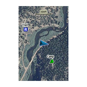
The new Garmin handheld GPS's including the GPSMAP 62 now have Birdseye satellite imagery... kinda like using Google earth:speedeast wrote:and anticipate the soon release of the Garmin GPSMAP 62st.
https://buy.garmin.com/shop/shop.do?pID=70144
I was considering the new GPSMap or even the Dakota/Oregon touchscreen GPS's to replace my ancient Magellan GPS. Add Birdseye (satellite imagery), some topo maps (for hiking, elevation data, etc), and City Navigator (car navigation) to make a complete on-road/off-road navigation system. About the only thing it won't do is speak directions... just beeps.
-
philipa_240sx
- Posts: 3808
- Joined: Thu Jun 21, 2007 7:30 am
- Location: Canada
Re: What's the best GPS nav unit?
Yeah, there really isn't a perfect marriage between the hiking type GPS's and the one's used for car navigation. The closest you can get is to add topo maps to your Nuvi... or route-able car maps to a Garmin handheld (GPSMap, Oregon, Dakota, etc). Either is a compromise though.Fisherdude wrote:GPS's still have a long way to go as far as the technology is concerned. I am running a new Garmin Nuvi and I am constantly dissapointed in it, especially off road.